


“Go back as far as you will into the vague past, there was always a Damascus. In the writings of every century for more than four thousand years, its name has been mentioned and its praises sung. To Damascus, years are only moments, decades are only flitting trifles of time. She measures time, not by days and months and years, but by the empires she has seen rise, and prosper and crumble to ruin. She is a type of immortality... Damascus has seen all that has ever occurred on earth, and still she lives. She has looked upon the dry bones of a thousand empires, and will see the tombs of a thousand more before she dies. Though another claims the name, old Damascus is by right the Eternal City.” -Mark Twain, The Innocents Abroad, 1869
Early History:
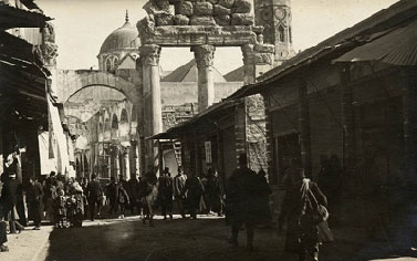
Rare are the countries that match the historic legacy of Syria. Damascus, the capital, is the oldest continually inhabited city in the world –a title purportedly rivaled chiefly by Aleppo, another Syrian city. To date, it is home to the first alphabet, first song, and first painting created by mankind. Recent archaeological findings trace the history of civilization in Syria back to the 10th millennium BC, thus, the oft-dubbed name “The Cradle of Civilization.”
It is believed that some of the earliest tribes that converted from hunting and gathering to agricultural settlements settled in the modern-day region of Syria around 9,000 BC. Later, the kingdoms of Ebla and Mari were established in the 3rd and 4th millennia BC. The 2nd and 3rd millennia BC witnessed the spread of the Hittites in Syria and the rise of Ugarit that was home to the first alphabet. The Phoenicians, Arameans, and Assyrians would later gain prominence on Syrian land with the latter empire spreading into Mesopotamia. By the 1st C. BC, the Hellenistic Empire would take hold of the region under Alexander the Great’s armies. This period saw the building of the city of Apamea, Lattakia, and Doura Europos. The Roman Empire would then take over and heighten its focus on Syria, which continued to prosper as a major trading hub. During this time, the city of Palmyra under the famous Queen Zenobia, grew in strength and seceded from the Roman Empire. The Palmyrene Empire stretched from northern Syria to Egypt and almost sacked Antioch until it was halted by the Roman armies. During the Roman era, 3 of the empire’s emperors were Syrian: Alexander Severus, Elagabalus, and Marcus Julius Philippus. The Roman Empire would then adopt Christianity and later become the Byzantine Empire, moving its capital to Constantinople.
Syria left an indelible mark on the history of Christianity for many reasons, chief of them being the conversion of Saul of Tarsus on the Road to Damascus to become Saint Paul. Saint Paul would then become the first missionary in Christianity, often called the “Father of Modern Christianity,” and would establish the first Christian church in Antioch. Syria would later become part of the Byzantine Empire until it is taken by the Muslims after the battle of Yarmuk (the master mind behind it, the legendary Khaled Ibn Al-Waleed, would choose the Syrian city of Homs as his burial place). Later, when the Umayyad dynasty took over the Muslim Empire, they chose Damascus as their capital. During that time, the Muslim Empire reaches the height of its power spanning three continents, Asia, Africa, and Europe. The Abbasid Dynasty would then take over, moving the capital to Baghdad. After a long period of power shifts between the Byzantines, Mamluks, Mongols (who destroyed much of Syria), Crusaders, Hamadanis, and others, the Ottoman Empire finally takes over Syria in the 16th C. and rules over it through World War I.
Modern History
With the conclusion of World War I and Syria gaining its independence from the Ottoman rule, the Syrian National Congress, headed by Hashim al-Atasi, crowns Faysal I as King of Syria in March 1920. In April 1920, the San Remo Conference puts Syria under French mandate against its will. In July, French troops enter Syria and are confronted at Maysaloun by the severely under-sized and under-equipped Syrian Army headed by the renowned Minister of War, Yousef Al-Azma. The French consequently defeat the Syrian army and Al-Azma heroically falls in battle. In August 1920, the French divide Syria and Lebanon, and in July 1932, the Republic of Syria is created with Mohammad Ali al-Abid as its first president. On April 17 1946, Syria gains its full independence after a long series of domestic uprisings and revolts, as well as robust diplomatic efforts led by the Syrian National Bloc. During the period between 1946 and 1970, Syria goes through an extended episode of political instability that brought numerous presidents, cabinets and parliaments.
In 1970, President Hafez Assad assumes power and brings much-needed stability to Syria. In his years in office, Syria goes through drastic transformations of industrialization, development, and military augmentation, catapulting Syria into a new dominant regional and international role. In those years, President Assad works tirelessly in an attempt to return the Golan, which was illegally occupied by Israel in 1967. Unfortunately, after several rounds of internationally- backed and US-brokered peace negotiations, Israel explicitly proves its unwillingness to abide by international law and free the land and people it occupies. In July 2000, President Bashar Assad takes office and maintains Syria’s policy that aims for a peaceful conclusion of the Arab-Israeli conflict, returning all occupied Arab territories and ending Israeli occupation. He also leads a major transformation of the Syrian economy based on social market principles, liberalizing the economy while simultaneously creating a social safety net. During his presidency, Syria reaches an unprecedented 6.1% economic growth rate, while a vigorous foreign policy maintains Syria’s positive role in the region and helps position it as a dynamic geopolitical hub between the different regions and actors.
Syrian Culture:
Syria has served as a major crossroads in the Middle East since prehistoric times, leaving it open to change and passing customs. The country’s melting pot of societies, as a result of its history, has led it to become one of the most ethnically diverse areas in the world, filled with a unique and flourishing culture. Today, Syria is witnessing a forward projectile dynamic of cultural life, intertwining a rich cultural heritage with a vibrant and promising modern movement.
Damascus, Cultural Capital
As the oldest inhabited city in the world, Damascus was named the 2008 Arab Capital of Culture by the United Nations Educational, Scientific and Cultural Organization. A series of festivals and celebrations took place throughout the year, including special musical performances, literary recitations, and dance recitals. For a list of the events, please click here. President of Syria, Bashar Al Assad, commented January 18, 2008 during the festival’s opening ceremony, “Damascus, Arab Capital of Culture, embodies a living example of the dialogue and coexistence of cultures; it represents a symbol of diversity within unity and an attribute of the beauty of the rainbow of human life. Through all this, Damascus provides definite proof that the notion of the conflict of civilizations is both null and void."
Cuisine
Syrian cuisine has long been renowned for its use of aromatic spices, vegetables, nuts, and grains, each specifically bended into an assortment of flavorful and nutritious dishes. The addition of lemon, onion, mint, and parsley as well as garlic is additionally utilized in vast quantities to accompany strong flavoring. A typical Syrian meal begins with the spread of various salads and hor d’oeurves including Tabouli, Fattoush, Hummus, and Baba Ghanoush. The main meal of the day, consumed early within the afternoon, often includes a meat dish, of typically chicken or beef, accompanied with seasoned vegetables and rice. Each meal is then followed by tea or coffee, platters of fruit, and sweetened pastries. Click here for traditional Syrian recipes.
Literature
While Syrian literature dates back hundreds of years, it most flourished during the late nineteenth century where aspiring Syrian writers contributed immensely to the literary and cultural renaissance of the Arab world. Prominent contemporary writers include Muhammad Maghout, also known as the father of Arabic free verse poetry, who revolutionized the traditional structures of poetry and playwriting and was an avid contributor to Syrian theater, television, and cinema. Ghada al-Samman, a novelist and journalist, is of the pioneers for women writers in Damascus. She continues to write short stories and novellas ranging in topic from romance to politics to the characteristics of the human persona. Perhaps one of the most renowned and well respected poets within the Arab world, Nizar Qabbani discussed issues of Arab nationalism, love, feminism, and religion within his simplistic style of writing. While predominantly a poet, Qabbani additionally wrote several works of prose and composed the lyrics for many revered Arab singers.

Overview of Thailand
Situated at the heart of the Southeast Asian mainland, Thailand is a hub of transportation and commerce. Extending 1,620 kilometres from north to south and 775 kilometres from east to west, it covers an area of 513,115 sq. km. It borders the Lao People's Democratic Republic on the north, the Union of Myanmar to the west, the Kingdom of Cambodia and the Gulf of Thailand to the East, and Malaysia to the south.
Historical Background:There are conflicting opinions as to the origins of the Thais. Three decades ago it could be said with presumed certainty that the Thais originated in Northwestern Szechuan in China about 4,500 years ago and later migrated down to their present homeland. However, this theory has been altered by the discovery of remarkable prehistoric artifacts in the village of Ban Chiang in the Nong Han District of Udon Thani Province in the Northeast. These include evidence of bronze metallurgy going back 3,500 years, as well as other indications of a far more sophisticated culture than any previously suspected by archaeologists. It now appears that the a Thais might have originated here in Thailand and later scattered to various parts of Asia, including some parts of China. Siam is the name by which the country was known to the world until 1939 and again between 1945 and 1949. On May 11, 1949, an official proclamation changed the name of the country to "Prathet Thai", or "Thailand", by which it has since been known. The word "Thai" means "free", and therefore "Thailand" means "Land of the Free."

Mr. Abhisit Vejjajiva
27th Prime Minister of Thailand
People
Thais are well-known for their friendliness and hospitality. The number of population in Thailand is approximately 64.6 million which consists of Thai (80%), Chinese (10%), Malay (3%), and the rest are minorities (Mons, Khmers, hill tribes). Ethnic Thais form the majority, though the area has historically been a migratory crossroads, and has thus produced a degree of ethnic diversity. About 7 million people reside in the capital city of Bangkok.
The official language is Thai which is spoken and written throughout the country. English is widely understood, particularly in Bangkok where it is almost the major commercial language. English and some European Languages are spoken in most hotels, shops and restaurants in major tourist destinations, and Thai-English road and street signs are found nationwide. The literacy rate in Thailand is approximately 90%.
Culture
The culture of Thailand incorporates a great deal of influence from India, China, Cambodia, and the rest of Southeast Asia. Part of Thailand’s culture and tradition has been inspired by Theravada Buddhism.
Like most Asian cultures, respect towards ancestors is an essential part of Thai culture. Thais have a strong sense of hospitality and generosity. Elders have by tradition ruled in family decisions or ceremonies.
The traditional Thai greeting, or “wai”, is generally offered first by the youngest of the two people meeting, with their hands pressed together, fingertips pointing upwards as the head is bowed to touch their face to the hands, usually coinciding with the spoken word “Sawaddee khrab” for male speakers, and “Sawaddee kha” for females. The elder then is to respond afterwards in the same way. This manner of greeting is a sign of respect and reverence for another.
“Muay Thai” or Thai boxing is the national sport in Thailand. “Muay Thai” achieved popularity all over the world in the 1990s. It has full-contact rules allowing strikes including elbows, throws and knees. Football (soccer) is also among one of the most widely viewed and liked sports in contemporary Thai society.
Thai cuisine blends five fundamental tastes: sweet, spicy, sour, bitter and salty. Some common ingredients used in Thai cuisine include garlic, chilly, lime juice, lemon grass, and fish sauce. The staple food in Thailand is rice, particularly jasmine rice (also known as “Hom Mali” rice) which is included in almost every meal. Thailand is the world’s largest exporter of rice, and Thais domestically consume over 100 kg of milled rice per person per year.
Multi-language press and media are widely-available in Thailand. There are numerous English, Thai and Chinese newspapers in circulation. Thailand is one of the largest newspaper markets in South East Asia with an estimated circulation of at least 13 million copies daily in 2003. Even upcountry, out of Bangkok, media flourishes. For example, according to Thailand’s Public Relations Department Media Directory 2003-2004, the nineteen provinces of northeast Thailand themselves hosted 116 newspapers in addition to radio, TV and cable.
Religion
95% of Thais are Buddhists of the Theravada tradition. Muslims are the second largest religious group in Thailand at 4.6%. Christians, mainly Catholics, represent 0.75% of the population. A tiny but influential community of Sikhs in Thailand and some Hindus also live in the country’s cities, and are mostly engaged in retail commerce. There is also a small Jewish community in Thailand, dating back to the 17th century.
- A treasure of history, a melting pot of civilizations and cultures.
- The variety and beauty of its landscape and climate attracts tourists to its beaches, mountains, plains and valleys.
- A dynamic nation of 72 million people with average age of 28

Committed to democracy and pluralism
- A multi-party parliamentary democracy since 1946.
- A secular democracy among more than 50 republics with predominantly Moslem population.
A free market economy
- Free and privately-owned media, with 16 nation-wide private TV Networks, broadcasting through two Turkish communication satellites.
- A member of NATO since 1952, Turkey is a part of the EU Customs Union since 1996, a candidate country to the EU since 1999 that started accession negotiations in October 2005.
Strategically placed
- A physical and culturel bridge between Europe and Asia, in the heart of Eurasia, bordering 12 nations and four seas.
- An outlet for the Black Sea basin countries to warm seas through the Turkish Straits.
- A significant contributor to the development of the newly independent states of Central Asia and the Caucasus.
- A prospective energy terminal of export of Caspian oil and natural gas.

A regional leader
- Contributor to UN peacekeeping operations world-wide.
Initiator of the Black Sea Economic Co-operation region which groups 11 nations from the Balkans to the Caucasus.
- Supporter of the Southeast European Countries Cooperation Process and initiator of the Multinational Peace Force Southeastern Europe; participant in the Kosova International Security Force and in Afghanistan and the Lebanon.
- Supporter of the Middle East Peace Process and the only regional country which participates in the Temporary International Presence in Hebron (TIPH) upon the request of both the Palestinian and Israeli sides.
An economic power
- A modern telecommunication and transportation network.
- 17th largest and 4th fastest growing economy in the world.
- 4th biggest donor country in the world with respect its GNP.
- Donor of $3.5 billion in economic and technical assistance including credits and $500 million in humanitarian aid to several countries.
- Russia alone, the investments of Turkish private entreprises amount to $10 billion.
- With an average annual growth rate of 5%, the fastest growing country in the Mediterranean.
- Exports to 155 countries, ranging from cable for the Channel Tunnel to cars to China.
- Europe's largest supplier of textiles and apparel.
- The only F-16 fighter plane factory outside the US.
- A regional center for international companies such as Coca-Cola, Chase Manhattan, Philips and Siemens.

A land of opportunity
- Privatization program including state enterprises active in airlines, banking, telecommunications and petroleum.
- Privatization and its $4.5 billion per year energy investment program offering important opportunities for foreign investors.
- One of the 10 big emerging markets.
The Southeastern Anatolia Project (GAP) for hydroelectric power generation and irrigation creating vast investment oppourtunities in agroindustries.
The Cradle of the Ottoman Turks
In front of the community park containing the shrine to Ertughrul Gazi in Sögüt, near the City of Bilecik, there stands one of those outsized flagpoles that are becoming such a conspicuous feature of the Turkish landscape.
However, here more than in most other places there's an ample justification for such nationalist posturing since it was here perhaps more even than in Bursa that the seeds of the Ottoman Empire were originally sown. Because the Conquest of Istanbul took place in 1453 A.D. it's easy for people to run away with the idea that the Ottomans came into their own more or less at the same time as the Tudors in the UK. Easy, but wrong, because in fact Ertughrul Gazi, the father of Osman Gazi who is usually thought of as the first of the Ottoman sultans, was actually born in 1188 A.D., at a time when large parts of what is now Turkey were still firmly under Selçuk sway.
Ertughrul's background is somewhat uncertain, although his birthplace is often given as Ahlat on the northern shore of Lake Van, he probably came from what is now Turkmenistan where he's honored by a mosque in his name in the capital, Ashgabat. An Oghuz Turk, he was leader of the Kayi tribe, which soon became involved in battling the Byzantines alongside the more powerful Selçuk Turks. For his efforts Ertughrul was rewarded with land near Ankara, although he later succeeded in seizing Sögüt (Willow), which is sometimes described as the first Ottoman capital.
Ertughrul's tomb stands to the left of the road as you come in by bus from Bilecik. Originally it would have been open to the skies but later a protective shrine was added, then rebuilt in its current form in 1886 A.D. during the reign of Sultan Abdülhamid II.
Today his grave is surrounded by soil samples brought here from all over the Turkic world in his honor. In the grounds outside can be seen the graves of Ertughrul's wife, Halime Hatun, and of his second son, Savci Bey, as well as a marker showing where Osman Gazi was originally buried before his body was transferred to Bursa when it succeeded Sögüt as the Ottoman capital.
At the back of the graveyard stands a cookhouse with, right beside it, a vast arena. Both come into their own over the second weekend of September when Ertughrul Gazi is commemorated with a festival that builds on a celebratory pilav günü (traditional rice day) dating back more than 700 years. Thousands of people show up annually to take part in the feasting and fun.
It might be tempting to take a quick look at the tomb, then hop back on the bus to Bilecik. Tempting but mistaken, since if you stroll downhill to the town center you'll soon discover modern Sögüt, an unexpectedly pretty little town vaguely reminiscent of Iznik.
The first thing you'll come to is a very attractive compound containing a high school, orphanage and mosque with twin minarets all dating back to the reign of Sultan Abdülhamid Second. Once to reach the much older Çelebi Sultan Mehmet Cami built between 1414 A.D. and 1420 A.D., but extensively restored by the enthusiastic Abdülhamid. In front of it there's a bust commemorating Ertugrul Gazi as well as a beautiful fountain decorated with Kütahya tiles and called the Kaymakam Çesmesi
(Governor's Fountain) after Kaymakam Sait Bey who had it placed there in 1919 A.D.
Nearby you'll find the Ethnographic Museum housed inside a lovely wooden mansion that started life as a clinic but had to be completely rebuilt after a fire in 1990 A.D. Inside it contains a fine collection of traditional costumes and lovely knitted purses, while the grounds host a few tombstones dating back to the time when Sögüt was the Roman Thebasion (Sebasiyon). Finally, take a quick look at the statue of Atatürk just where the bus back to Bilecik stops. It's surrounded by sculpted panels setting out the main events in Ottoman history.
The best base from which to visit Sögüt is probably Bilecik, a little-noticed town in Western Anatolia on the main road from Eskisehir to Adapazari (Sakarya). As you come into town you can hardly avoid noticing on the right a deep gorge whose flanks are dotted with the shattered remnants of minarets. During the Turkish War of Independence (1919-1922 A.D.), Bilecik, like Sögüt, was the scene of fierce fighting between Greeks and Turks, and these broken buildings stand as silent reminders.
A road winds down through the valley to the site of the shrine of Seyh Edebali (1206-1326 A.D.), spiritual advisor to Ertughrul Gazi and father-in-law of Osman Gazi. The shrine sits in a glorious location with fine views on both sides; look out in particular for the ruins of an old caravanserai now covered by a protective roof on the far side of the valley. At the foot of the steps leading up to the shrine is the impressive Orhangazi Cami, a mosque dating back to 1392 A.D. but with twin minarets added in 1905 A.D.
The hamam that once formed part of the complex has been turned into a souvenir shop where you can buy replicas of the old green Ottoman flag decorated with three white crescents. A nomadic- style tent has been set up in the grounds to serve refreshments to weary pilgrims who can imagine themselves transported back to the days of Ertughrul and Osman as they sip their tea.
Back on the lip of the valley you might want to pause to inspect the fine Belediye Sarayi (local municipality building). In the small park behind it the clock tower was erected in the reign of --you've guessed it --Sultan Abdülhamid II. Across the road a monument incorporates the old and new Turkish flags as well as Sheikh Edebali's uplifting words “Insani Yasat Ki, Devlet Yasasin (Let man flourish and the State will also flourish).”
Modern Bilecik has nothing to detain a visitor bar a cluster of reasonable hotels. However, it's also the best base for a visit to nearby Osmaneli, another of the many mini-Safranbolus of old Ottoman houses that dot this corner of Turkey yet pull in far fewer visitors. Long known as Lefke, Osmaneli merits a footnote in postal history since Turkey's first airmail letter was carried by plane from here to City of Bilecik in 1914 A.D. However, it's mainly interesting as a place to come to admire old Ottoman architecture without distracting crowds.

At the heart of town stands the Ulu Camii, a mosque commissioned by Rüstem Pasa, the grand vizier and son-in-law of Sultan Süleyman the Magnificent perhaps best known for the lovely little mosque he paid for in Istanbul's Tahtakale district.
It was designed by Yüzgech Mehmet Pasa, a pupil of the great Sinan's, and is currently undergoing restoration like many others in Turkey now. Facing it, the imposing two-storied Hükümet Konagi that once housed the local government is now slated to become a boutique hotel. Mehmet Pasa, a pupil of the great Sinan's, and is currently undergoing
restoration like many others in Turkey now. Facing it, the imposing two-storied Hükümet Konagi that once housed the local government is now slated to become a boutique hotel.
The pleasure of a visit to Osmaneli mainly lies in wandering the streets admiring the fine Ottoman konaks (mansions), many of them in a predictably poor state of repair but some making a strong comeback (look out, for example, for the lovely houses surrounding Balaban Meydani). However, you should certainly track down the remains of what was once the enormous Hagios Georgios (St. George) Greek Orthodox Church and the much less conspicuous shrine to Bayrakli Dede, a local evliya or holy man in whose life story colorful fables stand in for lack of actual fact. His tomb is draped with modern Turkish flags, hence its name.
Democracy and Human Rights:
With the completion of all constitutional steps, the division of Yemen into two separate states had ended for good. Since then, the Yemeni people began to aspire for socio-economic development and unity building and significant progress toward democracy, promoting Human Rights principles, ensuring women's participation in political, economical, and social life has been made.
The tangible achievements have been realized under the guidance of His Excellency the President of the Republic Ali Abdullah Saleh and attributed to the sincere efforts and the hard work of this proud nation.
Yemen has the honor of being the first country in the Arabian Peninsula to:
|
Over the past decade, the Yemeni Government has continued to demonstrate its commitment to democracy. In 1990, following the unification, a multi-party political system was established and in 1993 an independent electoral commission was formed.
Name: Islamic Republic of Iran
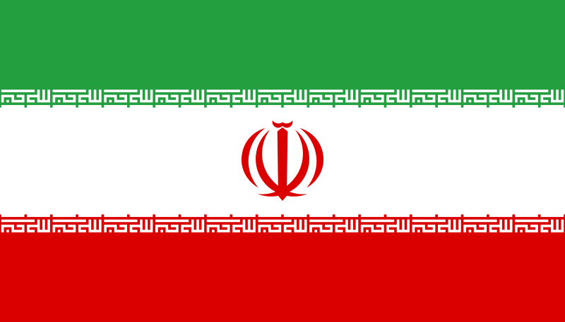
Flag Description: Three equal horizontal bands of green (top) white, and red; the national emblem (a stylized representation of the word Allah) in red is centered in the white band: ALLAHO AKBAR (God is Great) in white Arabic script is repeated 11 times along the bottom edge of the green band and 11 times along the top edge of the red band, totally 22 times to show 22nd of Bahman, the day of victory of the Islamic Revolution.
Area:
Total area: 1.648 million sq. km
Land area: 1.636 million sq. km
Land boundaries:
Afghanistan 936 km, Armenia 35 km,
Azerbaijan-proper 432 km,
Azerbaijan-Nakhichevan enclave 179 km,
Iraq 1,458 km,
Pakistan 909 km,
Turkey 499 km,
Turkmenistan 992 km.
Iran also borders the Caspian Sea (740 km)
Coastline: 2,440 km
Total: 5,440 km
Maritime claims
Contiguous zone: 24 nm
Continental shelf: Natural prolongation
Exclusive economic zone: Bilateral agreements or median lines in the Persian Gulf Territorial sea: 12 nm
Climate
Iran's climate is mostly arid or semiarid, subtropical along the Caspian coast
Terrain: Rugged, mountainous rim; high, central basin with deserts,
Mountains: Small, discontinuous plains along both coasts
Lowest point: Caspian Sea - 28 m
Highest point: Qolleh-ye Damavand 5,671 m
Natural resources: Petroleum, natural gas, coal, chromium, copper, iron ore, lead, manganese, zinc, sulfur
Land use
Arable land: 8 percent
Permanent crops: 0 percent
Meadows and pastures: 27 percent
Forest and woodland: 11 percent
Other: 54 percent
Irrigated land: 57,500 sq. km (1989 est.)
Environment
International agreements: Party to Endangered Species, Hazardous Wastes, Nuclear Test Ban, Ozone Layer Protection, Wetlands; Biodiversity, Climate Change, Decertification, Environmental Modification, Law of the Sea, Marine Life Conservation
People
Population: 60.1 million, including 36.8 million in urban areas and 23.3 million in rural areas (1996 estimate)
Population density: 38 persons per square kilometer (1998)
Active population: 17.3 million (1998 estimate)
Employed population: 15 million (1998 estimate)
Age structure
0-14 years: 45 percent (male 15,166,131; female 14,289,283)
15-64 years: 52 percent (male 17,326,388; female 16,731,470)
65 years and over: 3 percent (male 1,327,718; female 1,253,274) (July 1996 est.)
Population growth rate: 2.21 percent (1996 est.)
Birth rate: 19.5 births/1,000 population (1997 est.)
Death rate: 6.5 deaths/1,000 population (1997 est.)
Refugees and Immigrants: 1,963,780 (1999)
Sex ratio
At birth: 1.05 male(s)/female
Under 15 years: 1.06 male(s)/ female
15-64 years: 1.104 male(s)/ female
All ages: 1.05 male(s)/ female (1996 est.)
Infant mortality rate: 52.7 deaths/1,000 live births (1996 est.)
Health
Children mortality under 5 years rates (per 1000): 37.3 (1997)
Life expectancy: 69.5 (1997)
Doctors (per 100,000): 107.9 (1997)
Aids Rate (per 100,000): 0.30 (1997)
Religions
Shia Muslim 93 percent,
Sunni Muslim 6 percent,
Zoroastrian, Jewish and Christian 1 percent.
Languages: Persian
Literacy:
(6-14 years): 94.55 percent (Sept. 1997)
(15 and over):72.91 percent (Sept. 1997)
Urban areas: 96.88 percent
Rural areas: 91.37 percent
Male: 81.9 percent (nationwide) (1997)
Female: 67.0 percent (nationwide) (1997)
Government
Name of country : Islamic Republic of Iran (Jomhuriy-e Islamiy-e Iran)
Capital: Tehran
Administrative divisions:
28 provinces (ostanha, singular: ostan);
Ardebil, Azarbaijan-e Gharbi, Azarbaijan-e Sharqi,
Boushehr, Chahar Mahal va Bakhtiari, Fars, Golestan,
Gilan, Hamedan, Hormozgan,
Isfahan, Ilam, Kerman,
Kermanshahan, Khorassan, Khouzestan,
Kohkilouyeh va Buyer Ahmad, Kurdestan, Lorestan,
Markazi (Central), Mazandaran, Qazvin, Qom,
Semnan, Sistan va Balouchestan, Tehran, Yazd.
Independence: 1 April 1979 (Islamic Republic of Iran proclaimed)
National Holiday: Islamic Republic Day, 1 April (1979)
Constitution:
2-3 December 1979; revised 1989 to expand powers of the presidency and eliminate the premiership Parliament (Majlis-e Shora-ye-Islami) and the Council of Guardians of the Constitution. Under the provisions of the Constitution all legislations must first be approved by the Majlis and then be ratified by the Council of Guardians. They are signed into laws by the president. Two more legislative bodies were created in 1988 by (the late IRI leader) Imam Khomeini. They were the Expediency Discernment Council (EDC) and the Council of Policy Making for Reconstruction. Islamic Consultative Assembly (Majlis-e Shora-ye-Islami): Elections last held 18 February 2000
Judicial branch: Supreme Court
International organization participation:
CCC, CP, ECO, ESCAP,FAO, G-19, G-24, G-77, IAEA, IBRD,
ICAO, ICC, ICRM, IDA, IDB, IFAD, IFC, IFRCS, ILO, IMF,
IMO, Inmarsat, Intelsat,Interpol, IOC, IOM (observer),
ISO, ITU, NAM, OIC, OPEC, PCA, UN, UNCTAD, UNESCO, UNHCR,
UNIDO, UPU, WCL, WFTU, WHO, WIPO, WMO, WTO
Economy:
Average GDP Growth Rate: 3.8 percent (1995-1998)
GDP (current prices): 327,596 billion rials (1998)
Per Capita Income (current prices): 4,375 thousand rials (1998)
Gross National Savings /GNP: 26.1 percent (1998)
Net External Assets of the Banking System: 676 billion rials (Sep. 1999)
Banking System Facilities: 228,480 billion rials (Sep. 1999)
Liquidity (M2): 183,247 billion rials (Sep. 1999)
Trade Balance: 2,465 million dollars (Apr. - Sep. 1999)
Motor vehicles (cars) production: 206,000 set (1998)
Steel production: 6,000,000 ton (1998)
Oil export (barrel per day): 2,333,000 (1998)
Language: Modern Persian is the official language of Iran. An ancient literary language, Persian was written in the Pahlavi script before the Arab conquest in the 7th century. A new form written in the Arabic script developed during the 9th and 10th centuries; this is the basis of the Modern Persian language used today. As recently as 1950 there were several distinct dialects of spoken Persian, but due to the spread of public education and broadcast media, a standard spoken form, with minor regional accents, has evolved. Important languages of minority groups that have their own publications and broadcast programs include Azeri (a Turkic language of the Altaic family), Kurdish, Arabic, and Armenian.
Religion: Jafari Shiite of Islam has been the official religion of Iran since the 16th century. An estimated 93 percent of all Iranians follow Shia Islam, and nearly all are members of the Jafari group. Since Jafaries believe there are 12 legitimate successors, or imams, to Prophet Mohammad, they are often called Twelvers (Asna Ashari). The small remaining part of the population belongs to other Islamic denominations, primarily Sunni Islam. Iran also has small communities of Armenian and Assyrian Christians, Jews, and Zoroastrians.
Weather: Iran's varied landscape produces several different climates. On the northern edge of the country, the Caspian coastal plain, with an average elevation at or below sea level, remains humid all year. Winter temperatures rarely fall below freezing, and maximum summer temperatures rarely exceed 29 C (85 F). Annual precipitation averages 650 mm (26 in) in the eastern part of the plain (Mazandaran Province) and more than 1,900 mm (75 in) in the western part (Gilan Province).
At higher elevations to the west, settlements in the Zagros Mountain basins experience lower temperatures. These areas are subject to severe winters, with average daily temperatures below freezing, and warm summers, averaging 25 C (77 F) in the northwest and 33 C (91 F) in the central and southern Zagros. Annual precipitation, including snowfall, averages more than 280 mm (11 in) at higher elevations. Most precipitation falls between October and April.
The central plateau region also experiences regional variations. In Tehran, located at an elevation of 1,200 m (3,900 ft) on the northern edge of the plateau, the temperature averages 2 C (36 F) in January and 29 C (85 F) in July. The city receives an average of 230 mm (9 in) of precipitation annually. The arid basins of central and eastern Iran generally receive less than 200 mm (8 in) of precipitation per year. Yazd, for example, averages less than 70 mm (3 in) of precipitation. Its winters are cool, but temperatures almost never fall below freezing; summers are very hot, averaging 38 C (100 F) for most of July and August.
The coastal plains along the Persian Gulf and the Gulf of Oman in southern Iran have mild winters, with average January temperatures ranging from 7 C to 18 C (45 F to 64 F) in Khuzestan Province; average temperatures are even higher in Bandar-e 'Abbas on the Strait of Hormuz. Summers are very humid and hot, with temperatures exceeding 48 C (119 F) during July in the interior areas. Annual precipitation ranges from 145 mm to 355 mm (6 to 14 in) in this region.
People: The population of Iran was estimated at 65,865,302 in 2000. This figure is more than double the 1975 population of 33,379,000. Between 1956 and 1986 Iran's population grew at a rate of more than 3 percent per year. The growth rate began to decline in the mid-1980s after the government initiated a major population control program. By 2000 the growth rate had declined to 1 percent per year, with a birth rate of 20 per 1,000 persons and a death rate of 5 per 1,000. In 1998, 44 percent of the population was under the age of 15, 53 percent of the population being between 15 and 64, and only 4 percent 65 or older.
Overall population density in 2000 was 40 persons per sq km (104 per sq mi). Northern and western Iran are more densely populated than the arid eastern half of the country, where population density in the extensive desert regions is only 1 percent of the national average. In 1998, 61 percent of the population lived in urban areas. About 99 percent of rural Iranians resided in villages. Only 240,000 were nomads (people without permanent residences who migrate seasonally), a fraction of the 2 million nomads counted in 1966.
Tehran, the country's capital and largest city, serves as the main administrative, commercial, educational, financial, industrial, and publishing center. Iran's other major cities include Mashhad, a manufacturing and commercial center in the northeast and the site of the country's most important religious shrine; Esfahan, a manufacturing center for central Iran with several architecturally significant public buildings from the 17th and 18th centuries; Tabriz, the main industrial and commercial center of the northwest; Shiraz, a manufacturing center in the south near the ruins of the ancient Persian capital of Persepolis; and Ahvaz, the principal commercial and manufacturing center in the southwestern oil region.
Ethnic Groups: Iran's population is made up of numerous ethnic groups. Persians migrated to the region from Central Asia beginning in the 7th century BC and established the first Persian empire in 550 BC. They are the largest ethnic group, and include such groups as the Gilaki, who live in Gilan Province, and the Mazandarani, who live in Mazandaran Province. Accounting for about 60 percent of the total population, Persians live in cities throughout the country, as well as in the villages of central and eastern Iran. Two groups closely related to the Persians both ethnically and linguistically are the Kurds and the Lurs. The Kurds, who make up about 7 percent of the population, reside primarily in the Zagros Mountains near the borders with Iraq and Turkey. The Lurs account for 2 percent of the population; they inhabit the central Zagros region. Turkic tribes began migrating into northwestern Iran in the 11th century, gradually changing the ethnic composition of the region so that by the late 20th century East Azerbaijan Province was more than 90 percent Turkish. Since the early 1900s, Azeris (a Turkic group) have been migrating to most large cities in Iran, especially Tehran. Azeris and other Turkic peoples together account for about 25 percent of Iran's inhabitants. The remainder of the population comprises small communities of Arabs, Armenians, Assyrians, Baluchis, Georgians, Pashtuns, and others.
Modern History of Cyprus
 British rule lasted until August 1960 when, after a four-year liberation struggle, the island became independent and was proclaimed a Republic. The 1960 Constitution of the Cyprus Republic proved unworkable in many of its provisions and this made impossible its smooth implementation.
When in 1963 the President of the Republic proposed some amendments to facilitate the functioning of the state, the Turkish Cypriot community responded with rebellion (December 1964), the Turkish Cypriot Ministers withdrew from the Cabinet and the Turkish Cypriot public servants ceased attending their offices. Ever since then the aim of the Turkish Cypriot leadership, acting on instructions from the Turkish Government, has been the partition of Cyprus and its annexation to Turkey.
On July 15, 1974 a coup was staged in Cyprus by the military junta, then in power in Greece, for the overthrow of the then President of Cyprus, Archbishop Makarios. Turkey used this pretext to launch an invasion, with a full-fledged army against defenseless Cyprus on July 20, 1974. The invasion was carried out in two stages (July 20-22 and August 14-16), in which the Turkish troops eventually occupied 37% of the island's territory.
Nearly two hundred thousand Greek Cypriots, 40% of the total Greek Cypriot population, were forced to leave their homes in the occupied area and became refugees in their own country. The few thousand of Greek Cypriots who remained in their homes after the invasion were gradually forced, through harassment and intimidation, to leave their homes and move to the south. Now, only about six hundred have remained in their homes in the north, mainly in the Karpass area. Hundreds of people were reported missing and their fate has still not been ascertained. The island's rich cultural and religious heritage in the occupied areas has been looted and/or destroyed.
International bodies, such as the UN Security Council, the European Parliament, the Non-Aligned Movement, the Commonwealth and the Council of Europe, have condemned these ongoing violations of the fundamental human rights of the people of Cyprus. Despite this international condemnation, repeated UN Security Council Resolutions, calling for the respect of the independence, sovereignty and territorial integrity of the Republic of Cyprus, as well as the withdrawal of all foreign troops from its territory, remain unimplemented.
Several rounds of intercommunal talks between the island?s two main communities (Greek Cypriots and Turkish Cypriots) have not led to any positive development. This is due to the Turkish side's intransigence and continuing effort to partition the island by means of maintaining an occupation army of 40.000 soldiers and by the colonization of the occupied part of Cyprus with over 80,000 settlers from Anatolia.
Background for Historical Reference
Cyprus has played an important role in the history of the Eastern Mediterranean on account of its privileged geographical position on the crossroads between the Orient and the Occident. The island's prehistory runs as far back as the 8th millennium B.C. Subsequent cultural phases developed during the Neolithic, Chalcolithic and Bronze Age periods until end of the 2nd millennium B.C. However the most important event in the history of Cyprus is the arrival of the Achaean settlers at the end of the 12th and during the 11th century B.C.
The new Greek settlers brought a new vigour to the already flourishing culture of the island by establishing new towns and by introducing the Greek language, new techniques in metallurgy, new artistic styles and even religious elements from the Greek world.
In the subsequent Geometric period the hellenization of Cyprus was completed and this is, most probably, the period of the establishment city kingdoms, which are well attested in written sources in the following Archaic and Classical periods.
Cyprus was well-known to the ancients for its copper mines and forests. No wonder its wealth made it the object of contest among the great powers of the Eastern Mediterranean in antiquity: the Assyrians, the Egyptians and the Persians, who in turn became its masters.
During the 5th century B.C. Athens played an important role in Cyprus, cooperating with the main cities of the island against the Persians. It was during this time that Evagoras of Salamis rose to power, a figure of worldwide radiance at the time. On the partition of the empire of Alexander the Great, who finally liberated the island from the Persians, Cyprus became one of the most significant parts of the empire of the Ptolemies of Egypt; later it came under the dominion of the Romans in 58 B.C. Both during the Ptolemies and later under the Romans, the Sanctuary of Aphrodite at Paphos was the centre of the national, religious and cultural life of the island. In 330 A.D. it became a province of the Byzantine Empire.
During the Crusades period, Richard the Lionheart of England, on his way to the Holy Land, conquered the island. Richard passed the island onto the Knights Templar and they, in their turn, to the Lusignans from France, who established a Kingdom on the western feudal model (1192-1489).
The last Lusignan Queen, Caterina Cornaro, was forced to pass her rights onto the Republic of Venice, which ruled the island until 1571, when it was conquered by the Ottomans. The Ottoman period lasted until 1878 when the expansionist policy of Tsarist Russia led the Turks to cede Cyprus to Britain, which promised to help Turkey in the event of an attack by Russia on certain bordering provinces.
Cultural Heritage of Cyprus
 The History and Culture of Cyprus is among the oldest in the world. The first signs of civilization traced in archaeological excavations and research date back 9,000 years to the 7th millennium BC. This rich cultural landscape involves hundreds of archaeological sites scattered throughout the island, representing various historical periods in the island's evolution.
The discovery of copper in Cyprus in the 3rd millennium BC brought wealth to the island and attracted trade from its trading neighbors. Yet, although geographically placed at the crossroads of three continents Europe, Asia and Africa and a meeting point of great world civilizations, Cyprus has developed and for centuries maintained, its own civilization. It remained a center of Greek culture with Hellenistic, Roman, Byzantine, French, Venetian, Ottoman and British influences.
The Cyprus Department of Antiquities is tasked with the operation, maintenance, protection and preservation of the rich archaeological heritage of the island. Its activities comprise such areas as excavation and conservation of artifacts, the preservation of ancient monuments, the protection of ethnological and ecclesiastical art, the restoration of buildings of traditional architecture etc. The final goal of all these activities is the presentation of the island's unique cultural property to its people and visitors for the benefit of pleasure, knowledge and artistic inspiration.
Relevant to the excavations and complementary to them is the task of maintenance and protection of ancient monuments and antiquities in general. This includes reconstruction and/or maintenance of ancient theatres, sanctuaries, castles, churches and other monuments of every nature as well as movable antiquities, metallurgy, handicraft, icons, items of religious and popular art dating back to Neolithic Times and up to 1940 A.D. Maintenance of Mosaics and frescoes is also included.
The Cyprus Museum in Nicosia houses the richest and most representative collection of Cypriote antiquities in Cyprus. In its exhibition rooms one may see some of the most important pieces of Cypriote art and get a comprehensive picture of the Cypriote culture from the Neolithic period to the Roman times.
There are also district archaeological museums in all towns, two site museums, in Episkopi (Limassol) for the antiquities of Kourion and at Kouklia (Paphos) for the antiquities of Paleapaphos, Folk Art Museums at Yeroskipou, Lefkara and Phikardhou and an Ethnological Museum in the Nicosia House of Hadjigeorgakis Kornesios.
Most of the ancient monuments and archaeological sites on the island are open to the public and visitors may, with the aid of inexpensive guide books, tour the sites.
On the other hand ancient theatres have been fully reconstructed and host several theatrical, dance, musical and other performances. At the same time mobile Cyprus antiquities in the form of representative collections are sent abroad for exhibition. Such touring exhibitions are organized in many parts of the world.
Cypriote antiquities are also objects of scientific study during international congresses and seminars on archaeology.
An achievement of the Department of Antiquities is the inclusion in 1980, of both Paleapaphos (Kouklia) and Nea Paphos (Kato Paphos) in the World Cultural Heritage List of Unesco.
In 1986 nine Byzantine Churches situated in the Troodos range, those of Agios Nicolaos tis Stegis in Kakopetria village, Agios Ioannis Lambadistis in Kalopanayiotis village, Panayia tou Moutoulla in Moutoullas village, Archangelos in Pedoulas village, Panayia tis Poditou in Galata village, Stavros tou Agiasmati in Platanistasa village and Asinou near Nikitari village were also included in the World Cultural Heritage List of Unesco.
Cultural Life of Cyprus
There is an intense and active interest amongst all the people in Cyprus in fostering the creative drive in the field of Letters and the Arts and to strengthen cultural awareness.
Both the Government as well as non-governmental organizations and individuals have given high priority in making culture available to all, so that there is a greater participation and receptiveness on behalf of the public in the island's cultural life and in disseminating and projecting cultural achievements abroad in order to highlight Cyprus' links with international culture.
Particular emphasis is placed on promoting literature, music, dance (modern and classical), the visual arts and the cinema. In addition a special arts festival (The "Kypria") is organized annually with a view to upgrading the art movement on the island and highlighting its links with international culture. Since its inception, in 1993, this has become an institution making high quality cultural entertainment accessible to a wide range of people. The various performances include: theatre, ballet, opera, music. Alongside well-known international artists or ensembles, Cypriot artists who have distinguished themselves abroad and acquired international reputation are also invited to participate.
The Damage Done by Turkey
The Government of Turkey has been found by the European Court of Human Rights as being responsible for violations of human rights and other illegal activities in the occupied part of Cyprus.
The systematic nature of the looting and stealing that has taken place and much of the vandalism, suggests that Turkish official policy has directly or indirectly encouraged much of the destruction, damage and looting that has occurred. Further damage has been caused by erosion and neglect.
Recovery of Stolen Items
The Cyprus Police Force in cooperation with the Department of Antiquities, the Church of Cyprus and collectors of art treasures, have since 1974 constantly endeavored to inform INTERPOL, police forces of other countries, and the international art market about items stolen or looted from the northern part of Cyprus.
There have been notable successes which resulted in the recovery of icons and ancient earthenware from the UK in 1974, ancient figurines (3000 BC) from auctioneers in London in 1976, icons in the Netherlands in 1981, and a large number of icons, mosaics and frescoes from Germany in 1997 and in the Netherlands in 1998.
One of the most notable cases has been the recovery of mosaics taken from the Church of Kanakaria in 1989, when an Indianapolis Court reaffirmed their ownership by the Church of Cyprus and ordered a US art dealer to return them to Cyprus.
The authorities of Cyprus are constantly trying to obtain possession of art works stolen from the occupied area and are currently in Europe, North America and Japan.
Devastation in Occupied Cyprus
One of the most tragic consequences of the 1974 Turkish invasion and continued occupation of the northern part of Cyprus has been the deliberate destruction, looting, pillage and desecration of Cyprus? unique cultural and religious heritage.
Geography & Climate
 Cyprus has an intense Mediterranean climate with the typical seasonal rhythm strongly marked in respect of temperature, rainfall and weather generally. Hot, dry summers from mid-May to mid-September and rainy, rather changeable winters from November to mid-March are separated by short autumn and spring seasons.
In summer the island is mainly under the influence of a shallow trough of low pressure extending from the great continental depression centered over southwest Asia. It is a season of high temperatures with almost cloudless skies. In winter Cyprus is near the track of fairly frequent small depressions which cross the Mediterranean Sea from west to east between the continental anticyclone of Eurasia and the generally low pressure belt of North Africa.
These depressions give periods of disturbed weather usually lasting for a day or so and produce most of the annual precipitation, the average rainfall from December to February being about 60% of the average annual total precipitation for the island as a whole, which is 500 mm. Precipitation increases from 450 millimetres up the south-western windward slopes to nearly 1.100 millimetres at the top of the Troodos massif. On the leeward slopes amounts decrease steadily northwards and eastwards to between 300 and 400 millimetres in the central plain and the flat south-eastern parts of the island.
The narrow ridge of the Kyrenia range, stretching 160 kms from west to east along the extreme north of the island produces a relatively small increase in rainfall of around 550 millimetres along its ridge at an elevation of 1.000 metres. Statistical analysis of rainfall in Cyprus reveals a decreasing trend of rainfall amounts in the last 30 years. Rainfall in the warmer months contributes little or nothing to water resources and agriculture. Autumn and winter rainfall, on which agriculture and water supply generally depend, is somewhat variable from year to year. Snow occurs rarely in the lowland and on the Northern Range but falls every winter on ground about 1.000 metres usually occurring by the first week in December and ending by the middle of April. Although snow cover is not continuous, during the coldest months it may lie to considerable depths for several weeks especially on the northern slopes of Troodos.
Temperatures are high in summer and the mean daily temperature in July and August ranges between 29 degrees Celsius on the central plain to 22 degrees Celsius on the Troodos mountains, while the average maximum temperature for these months ranges between 36 degrees Celsius and 27 degrees Celsius respectively. Winters are mild with a mean January temperature of 10 degrees Celsius on the central plain and 3 degrees Celsius on the higher parts of the Troodos mountains and with an average minimum temperature of 5 degrees Celsius and 0 degrees Celsius respectively.
Relative humidity of the air is on average between 60% and 80% in winter and between 40% and 60% in summer with even lower values over inland areas around midday. Fog is infrequent and visibility is generally very good. Sunshine is abundant during the whole year and particularly from April to September when the average duration of bright sunshine exceeds 11 hours per day.
Winds are generally light to moderate and variable in direction. Strong winds may occur sometimes, but gales are infrequent over Cyprus and are mainly confined to exposed coastal areas as well as areas at high elevation.
Land & Crops
The coastline is indented and rocky in the north with long, sandy beaches in numerous coves in the south. The northern coastal plain, covered with olive and carob trees, is backed by a steep, narrow mountain range of limestone, the Northern or Pentadactylos Range, rising to a height of 1.024 meters.
In the south-west the extensive mountain massif of Troodos, covered with pine, dwarf oak, cypress and cedar, culminates in the peak of Mount Olympus, 1.952 metres above sea level. Between the two ranges lies the fertile plain of Messaoria to the east and the still more fertile irrigated basin of Morphou to the west. The total area of arable land is about 430.000 hectares or 46,8% of the whole island. The total forest land is 1.735 square kms. i.e. 18,74% of the total area of the island. Cyprus has two salt lakes.
The principal crops in the lowlands are cereals (wheat and barley), vegetables, potatoes and citrus. The olive tree grows everywhere, but flourishes particularly on the sea-facing slopes. Vineyards occupy a large area on the southern and western slopes of the Troodos mountains. Deciduous fruit trees are grown in the fertile mountain valleys. The most valuable export crops are potatoes, citrus, fruits, vegetables and table grapes. Sheep and goats are mainly reared in sheds or tethered, but the semi-nomadic traditional system of grazing is still exercised.
Area and Population
Cyprus is the third largest island in the Mediterranean with an area of 9.251 sq. kilometers. It has a maximum length of 240 kms from east to west and a maximum width of 100 kms from north to south. It is situated 380 kms north of Egypt, 105 kms west of Syria and 75 kms south of Turkey.
The Greek mainland is some 800 kms to the west. The nearest Greek islands are Rhodes and Carpathos, 380 kms to the west.
Cyprus' population in July 2004 was 775,927. Population distribution by ethnic group is 85% Greek Cypriots including Maronites, Armenians and Latins and 12% Turkish Cypriots. Foreigners residing in Cyprus account for 3% of the population.
Prior to the Turkish invasion in 1974 the two communities lived together in roughly the same proportions (4 Greeks: 1 Turk) in all the six administrative districts. The capital of the island is Nicosia with a population of 195.300 in the sector controlled by the Cyprus government. It is the only divided capital in Europe.
It is situated roughly in the center of the island and is the seat of government as well as the main business center.
The second largest town is Limassol on the south coast, with a population of around 155.500. After 1974 it has become the island?s chief port, an industrial center and an important tourist resort.
Larnaca, in the south-coast of the island, has a population of 68.800 and is the country's second commercial port and an important tourist resort. To the north of the town one can find the country's oil refinery while to the south, the Larnaca International Airport.
Finally, Paphos, on the south-west coast, with a population of around 39.500, is a fast-developing tourist resort, home to the island?s second international airport and an attractive fishing harbor.
The towns of Famagusta, Kyrenia and Morphou have been under Turkish occupation since the Turkish invasion of 1974. The original Greek Cypriot inhabitants have been forced to flee to the government-controlled area. In their place the Turkish authorities have imported thousands of settlers from Anatolia.

Geography
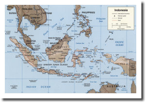
The country stretches around the equator for 5,150 km (3,200 miles) - roughly the distance between Los Angeles and New York . The comparative map below should give you an idea of the country's size. It is the largest archipelago in the world.
Strategically, the country lies between the Australian and Asian continents and the Pacific and Indian Oceans. Seas and oceans comprise 81 percent of the total area of the Republic. Of its land area of 1,919,440 sq km, rivers and lakes occupy 93,000 sq km and land features 1,826,440 sq km.
Five main islands and 30 smaller archipelagos are home to the majority of the population. The main islands are Kalimantan (1,539,400 sq km), Sumatra (473,606 sq km), Irian Jaya (421,981 sq km), Sulawesi (189,216 sq km), and Java (132,187 sq km). Java alone is home to roughly 70 percent of the country's population!
Indonesia shares the island of Papua with Papua New Guinea and the island of Kalimantan with Malaysia and Brunei Darussalam.
Across the country, the land is generally covered by thick tropical rain forests, where fertile soil is continuously replenished by volcanic eruptions like those on the island of Java . But Indonesia is also mountainous, with some 400 volcanoes, of which 100 are still active.
Climate and Weather
Due to the large number of islands and mountains in the country, temperatures vary. Along the coastal plains, the average is 28°C (82°F); for inland and mountain areas, it is 26°C (79°F); and, in the higher mountain areas, the average is around 23°C (73°F). Like other tropical countries, Indonesia has a high average relative humidity, usually between 73 and 87 percent.
Flora and Fauna
![]()
Ancient Times
Historians believe that Indonesia was linked with the Asian mainland during the Pleistocene period (four million BC). This period was also related to the first appearance of the Hominids; what is today called 'Java Man' inhabited Indonesia as early as two million to 500,000 years ago. 'Java Man' is a short name for Pithecanthropus Erectus , a human-like species whose fossilized remains were discovered by the scientist Eugene Dubois on the island of Java.
![]()
Buddhist and Hindu Kingdoms
Much later, Indonesia developed many well-organized kingdoms. Ruled by indigenous Rajas who embraced the Hindu and Buddhist religions, these kingdoms grew very civilized. Today, this time in history is called the period of Buddhist-Hindu Kingdoms. It lasted from ancient history to the 15th century
The first Buddhists arrived in Indonesia from around 100 to 200 AD from India. One of the most famous Buddhist kingdoms in Indonesian history is Sailendra (750-850 AD). During this period, the famous Buddhist temple at Borobudur was built. The dynasty's replacement, the Hindu kingdom of Mataram began the era of Hindu kingdoms. The mightiest Hindu kingdom in Indonesia's ancient history was the Majapahit Empire. Under the reign of King Hayam Wuruk (1331-1364 AD), the empire enjoyed tributary relationships with territories as far away as Vietnam, Cambodia, and the Philippines.
![]()
Islam Arrives
Gujarati and Persian merchants who embraced Islam started to visit Indonesia in the 13th century. Along with trade, they introduced Islam to the Indonesian Hindus, particularly in the coastal areas of Java. Islam then spread further east to the Bone and Goa Sultanates in Sulawesi, Ternate and Tidore in the northern part of Maluku, and the east part of Lombok. Besides those areas, Islam also expanded to into Banjarmasin, Palembang, Minangkabau, Pasai, and Perlak.
![]()
European Period
European influence in Indonesia began when the Portuguese, in search for spices, landed in 1512. Both the Portuguese and the Spanish spread Christianity in Indonesia. Meanwhile, the Dutch established an organized merchant trade called Dutch East India Company (VOC) in 1602 to tap the rich spices territories. After the seizure of Ambon in Maluku (1605) and Banda Island (1623), the Dutch enjoyed a trade monopoly in the "Spice Islands."
In 1814 the British came to Indonesia. During the Napoleonic wars in Europe, when Holland was occupied by France, Indonesia fell under the rule of the British East India Company. After the fall of Napoleon, the British and Dutch signed a convention in which it was agreed that Dutch colonial possession dating from 1803 onwards should be returned to the Dutch administration in Batavia (present-day Jakarta). Thus, the Indonesian archipelago once again became a Dutch possession in 1815.
Throughout the period of colonization, Indonesians had been fighting for their independence. This struggle, begun in the 1600s, climaxed with a proclamation of independence in 1945, and continued for a few years more.
![]()
Independence
When World War II broke out, the Japanese occupied the Dutch East Indies after the surrender of the Dutch colonial army in March 1942. Three years later, on August 14, 1945, the Japanese surrendered to the Allied Forces. To Indonesia's leaders, the power vacuum in Jakarta looked like an open window of opportunity to proclaim their independence. On 17 August 1945, Indonesian national leaders Soekarno and Dr. Mohamad Hatta proclaimed Indonesia's independence on behalf of the Indonesian people. The proclamation took place at Jalan Pengangsaan Timur No.56, Jakarta, and was heard by thousands of Indonesians nationwide through a secret radio broadcast from a captured Japanese radio station, Jakarta Hoso Kyoku. An English translation of the proclamation was broadcast overseas soon afterwards.
A Diverse Nation
In its ethnic groups, languages, culture, and religion, Indonesia is a very diverse nation. This great diversity is reflected in the country's national motto Bhinneka Tunggal Ika which means "Unity in Diversity."
- Ethnic Groups
Some 300 ethnic groups call Indonesia home, but most (45 percent) of Indonesians are Javanese. In addition, 14 percent are Sundanese, 7.5 percent Madurese, 7.5 percent coastal Malays, and 26 percent are of other ethnic groups. - Languages
There are more than 700 languages and dialects spoken in the archipelago. They normally belong to the different ethnic groups of the population. Some of the distinctly different local languages are: Acehnese, Batak, Sundanese, Javanese, Sasak, Tetum of Timor, Dayak, Minahasa, Toraja, Buginese, Halmahera, Ambonese, Ceramese, and several Irianese languages. To make the picture even more colorful, these languages are also spoken in different dialects.
Bahasa Indonesia is the national language. It is similar to Malay and written in Roman script based on European orthography. English is the most prevalent foreign language. Also, some Dutch is still spoken and understood in the bigger cities and French increasing in its popularity at the better hotels and restaurants. - Culture
Indonesia's active history has encouraged the growth of many unique cultures. On Java, the Javanese of Central and East Java are known for having several layers of formality in their language. In Javanese, to speak to a boss and then to a child is like speaking two different languages. The Toraja of Sulawesi are famous for their elaborate funeral ceremonies. Often several days long, these ceremonies bring the whole village together in a feast, a procession, and a hillside burial. And the Minangkabau of Sumatra still maintain a matrilineal society. Everything from houses to animals is inherited from mother to daughter.
Today, the country maintains this cultural richness, even as it expands into new areas. The traditional music of the gamelan and angklung coexists with new dangdut and rock and roll. The ancient art of wayang kulit, or shadow puppetry, complements the modern Indonesian film industry. And, while the themes and story from historic epics like the Ramayana persist, newer literature like that of the author Pramoedya Ananta Toer has become an irrevocable part of Indonesian culture. - Religion
Six world religions are formally recognized in Indonesia: Islam, Catholicism, Protestantism, Confucianism, Hinduism and Buddhism. Nevertheless, other faiths can be found, especially in isolated societies. These religions, called traditional faiths, are also accepted. According to recent counts, approximately 85 percent of the population is Muslim, 11 percent is Christian (Protestants and Catholics), and 4 percent is Hindu, Buddhist, Confucian, or traditional.
![]()
WHAT SOME PEOPLE HAD TO SAY:
Albert Einstein We owe a lot to the Indians, who taught us how to count, without which no worthwhile scientific discovery could have been made.
Mark Twain India is the cradle of the human race, the birthplace of human speech, the mother of history, the grandmother of legend, and the great grandmother of tradition. Our most valuable and most constructive materials in the history of man are treasured up in India only.
French scholar Romain Rolland If there is one place on the face of earth where all the dreams of living men have found a home from the very earliest days when man began the dream of existence, it is India.
Hu Shih, former Ambassador of China to USA India conquered and dominated China culturally for 20 centuries without ever having to send a single soldier across her border.
Grant Duff British Historian of India Many of the advances in the sciences that we consider today to have been made in Europe were in fact made in India centuries ago.

CURRENT INFORMATION:
-There are 3.22 Million Indians in America. 38% of Doctors in America are Indians. 12% of Scientists in America are Indians. 36% of NASA employees are Indians. 34% of MICROSOFT employees are Indians 28% of IBM employees are Indians 17% of INTEL employees are Indians 13% of XEROX employees are Indians
-First democracy to elect a woman Prime Minister.
India is the 7th nuclear power in the world
India is the 5th largest economy in the world
India is the largest democracy in the world
India has the 2nd largest population in the world
India is the 4th nation in the world to have developed/or developing a nuclear submarine
India is the 5th nation in the world to be in the multibillion dollar space commerce business.
India is the 4th nation in the world to develop (or nearly to) ICBM's(can travel up to 14,000km)
India is the 3rd nation in the world, to be able to develop land based and sea based cruise missiles.

TECHNOLOGICAL/SCIENTIFIC ACHIEVEMENTS
- the technique of algorithm used in computer science today.
- the science of algebra.
- the concept of zero - on which ultimately rests the binary code which has given us all software
- the technique of manufacturing crystal (sugar)cane sugar
- the making of camphor
- the making of tin
India never invaded any country in her last 10000 years of history.
India invented the Number System. Zero was invented by Aryabhatta.
The World's first university was established in Takshila in 700BC. more than 10,500 students from all over the world studied more than 60 subjects. The University of Nalanda built in the 4th century BC was one of the greatest achievements of ancient India in the field of education.
Although modern images of India often show poverty and lack of development, India was the richest country on earth until the time of British invasion in the early 17th Century.
The art of Navigation was born in the river Sindh 6000 years ago.
The value of pi was first calculated by Budhayana, and he explained the concept of what is known as the Pythagorean Theorem. He discovered this in the 6th century long before the European mathematicians.
Algebra, trigonometry and calculus came from India
According to the Gemological Institute of America, up until 1896, India was the only source for diamonds to the world.
The earliest reservoir and dam for irrigation was built in Saurashtra.
Chess (Shataranja or AshtaPada) was invented in India.
The place value system, the decimal system was developed in India in 100 BC.
One-third of the engineers in Silicon Valley are of Indian descent, while 7% of its high-tech firms are led by an Indian ceo. Some success storiesare well known, such as Vinod Khosla, co-founder of Sun Microsystems, and Sabeer Bhatia, who founded Hotmail and sold it to Microsoft for $400 million. The number of New Economy millionaires of Indian descent is now in the thousands. Massachusetts' Gururaj Deshpande, co-founder of a number of network technology companies, is worth between $4 billion and $6 billion. Says Krish Prabhu, ceo of French telecom giant Alcatel's U.S. operations: "Indians have succeeded in the high-tech field, and don't face that glass ceiling now. They have a proven track record."
Six Indians led by Azim Hasham Premji of Wipro are among 39 “tech billionaires” outside the United States, more than half of them having achieved the status since July last, according the authoritative financial magazine “Forbes Global”.
Japan with 15 billionaires has the maximum number in the category followed by India and Germany with six each. Taiwan and Britain have two each. Honk Kong, France, Canada, Ireland, Italy, Israel, Spain and Sweden account for one each. (a little outdated now, from Reuter's i think)